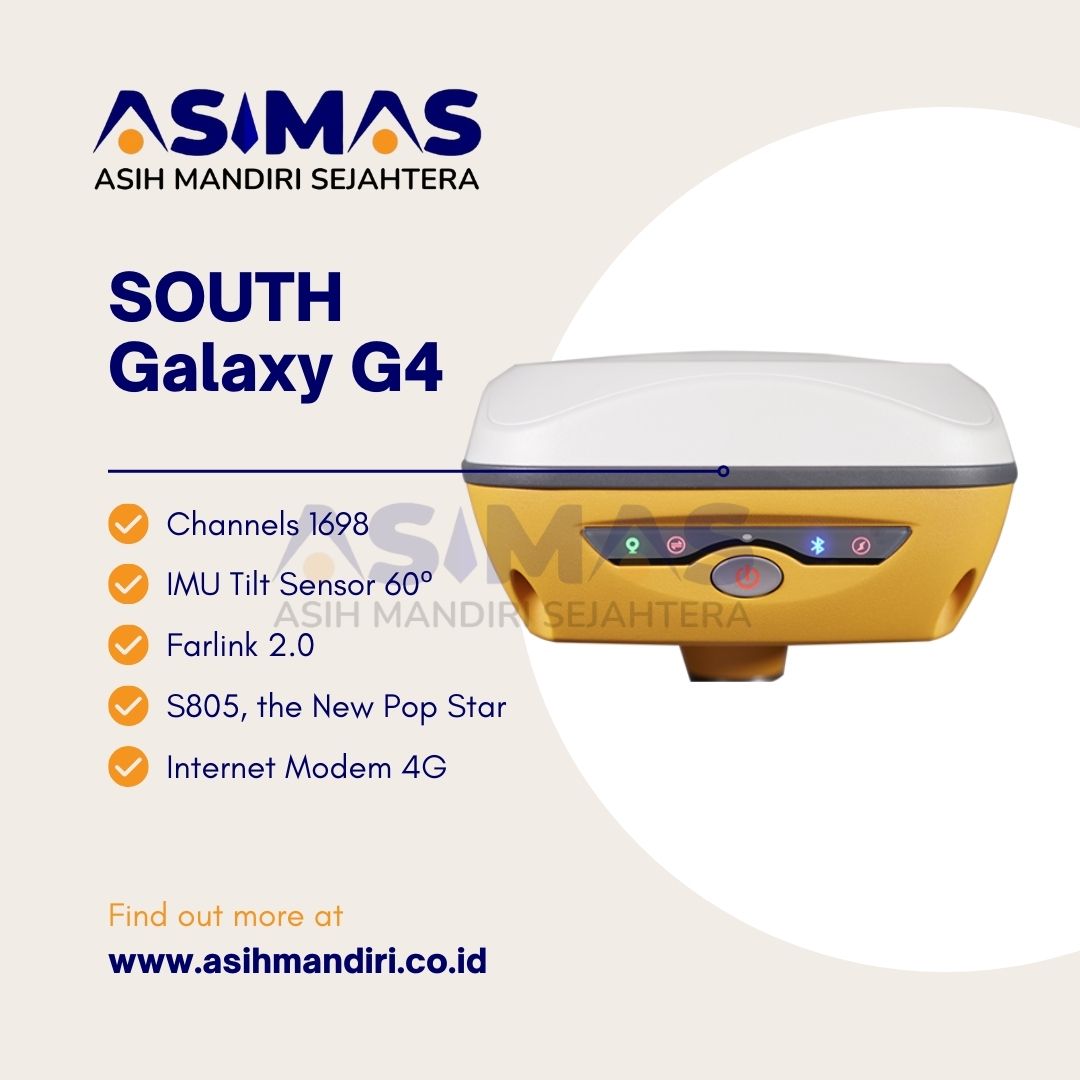
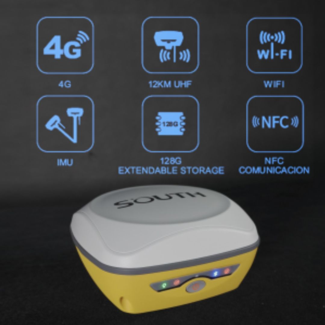
GPS Geodetik South Galaxy G4

  • Channels1698
  • IMU Tilt Sensor60°
  • Internet Modem4G
  • UHF Radio410 – 470MHz
  • GPS L1, L1C, L2C, L2P, L5
  • GLONASS G1,G2,G3
  • GALILEO E1, E5A, E5B, E6C
  • BEIDOU B1I, B2I, B3I, B1C, B2A, B2B
Category:

GPS GEODETIK SOUTH GALAXY G4
GPS Geodtik South Galaxy G4

Gps Geodetik South Galaxy G4 yang keunggulan utamanya adalah visibilitas yang makin oke buat kita para pengguna Gps Gedodetik G4. Ini bener-bener ngejaga keselamatan kita, terutama di kondisi sulit kayak di hutan atau saat malam hari.

Jadi, status kerja receiver ini sekarang lebih keliatan dari jarak yang jauh.

Nah, tim riset Gps Geodetik South Galaxy emang jago banget. Mereka pakai teknologi canggih, termasuk algoritma SOUTH, buat pastiin koreksi data yang akurat, bahkan di lingkungan yang ekstrim sekalipun.

Ada juga fitur fixed-keep yang memungkinkan pengukuran terus menerus beberapa menit setelah kehilangan solusi tetap.

Makin keren, teknologi mereka menggunakan Beidou PPP dan Galileo HAS, yang memungkinkan positioning titik yang sangat tepat lewat sinyal satelit, bahkan di area tanpa koreksi CORS.

Jadi, buat teman-teman yang sering berkutat dengan alat ukur, ini nih pilihan yang keren buat dipertimbangkan. Gak cuma keren, tapi juga aman dan akurat di berbagai kondisi. Semangat terus di lapangan, ya!

Save Weak Signal

SOUTH selalu tanpa henti berupaya untuk berinvestasi dalam inovasi. Melalui penelitian yang tak kenal lelah dan perbaikan pada algoritma pemosisian multisatelit, kami telah mengembangkan mesin GNSS S805.

Mesin ini dilengkapi dengan 1698 saluran untuk melacak lebih banyak satelit dan sinyal yang lemah. Peningkatan yang lebih penting ada pada tingkat keberhasilan dan kecepatan dalam mendapatkan solusi tetap.

Sebelumnya, di bawah hutan lebat dan dikelilingi bangunan, mustahil untuk mendapatkan solusi tetap. Kini dengan G4, kamu gak perlu menunggu lama untuk mendapatkan solusi tetap. Dulu butuh beberapa menit, tapi sekarang hanya beberapa detik saja.
Less Limitation Better Performance

dengan lebih sedikit batasan dan performa yang lebih baik.

Setelah bertahun-tahun mendapatkan pembaruan hardware dan firmware, Farlink 2.0 mampu menangani volume data yang lebih besar dan memberikan transmisi yang lebih stabil.

Selain itu, Farlink 2.0 dapat menerima data dari satu base tertentu.

Meskipun ada beberapa base yang mentransmisikan dengan frekuensi yang sama, rover kamu akan menerima data dari base yang benar.

Setiap radio telah menjalani pengujian suhu ekstrem mulai dari 20℃ hingga 60℃. Ini menunjukkan kehandalan Farlink 2.0 di berbagai kondisi suhu yang ekstrem.

Almost All-time Usable

Nyaris bisa digunakan sepanjang waktu! Pada tahun 2023, diluncurkan dua pembaruan utama: Calibrate-free Initialization & Stability Improvement.

Untuk tahun 2024, kami memiliki pembaruan baru lagi: ketika kamu memutar tongkat, sensor IMU tetap dapat digunakan.

Di masa lalu, para surveyor sering memutar tongkat ketika mengubah arah perjalanan atau menyesuaikan posisi receiver, terkadang itu mematikan IMU.

Nah, pembaruan terbaru ini menghilangkan kehilangan status Inertial-Measurement-Usable dalam sebagian besar situasi untuk meningkatkan ketersediaan dan produktivitas IMU. Makin canggih dan nyaman untuk pekerjaan survei kamu!

Specification

GNSS Features Channels 1698
GPS L1, L1C, L2C, L2P, L5
GLONASS G1,G2,G3
BDS B1I,B2I,B3L,B1C,B2A,B2B*
GALILEO E1,E5A,E5B,E6C*
SBAS L1C,L1A*
NavIC/ IRNSS L5*
QZSS
MSSL – Band(Reserve)
L1,L2C,L5*
Positioning output rate 1Hz~20Hz
Initialization time < 10s
Initialization reliability >99.99%
Positioning Precision Code differential GNSS Horizontal: 0.25 m + 1 ppm RMS
Vertical: 0.50 m + 1 ppm RMS
Static(long observations) Horizontal: 2.5 mm + 0.1 ppm RMS
Vertical: 3 mm + 0.4 ppm RMS
Static Horizontal: 2.5 mm + 0.5 ppm RMS
Vertical: 3.5 mm + 0.5 ppm RMS
Rapid static Horizontal: 2.5 mm + 0.5 ppm RMS
Vertical: 5 mm + 0.5 ppm RMS
PPK Horizontal: 3 mm + 1 ppm RMS
Vertical: 5 mm + 1 ppm RMS
RTK(UHF) Horizontal: 8 mm + 1 ppm RMS
Vertical: 15 mm + 1 ppm RMS
RTK(NTRIP) Horizontal: 8 mm + 0.5 ppm RMS
Vertical: 15 mm + 0.5 ppm RMS
RTK initialization time 2 ~ 8s
SBAS positioning Typically < 5m 3DRMS
BANDA-L Horizontal: 5-10cm (5-30min)
Vertical: 10-30cm (5-30min)
IMU Less than 10mm + 0.7 mm/° tilt to 30°
IMU tilt angle 0° ~ 60°
Hardware Performance Dimension 135mm(W)×135mm(L)×84.75mm(H)
Weight 890g(battery included)
Material Magnesium aluminum alloy shell
Operating temperature -25℃~+65℃
Storage temperature -35℃~+80℃
Humidity 100% Non-condensing
Waterproof/Dustproof IP68
Shock/Vibration MIL-STD-810G(withstand 2meters pole drop onto the cement ground naturally)
Power supply 6-28V DC, over voltage protection
Battery Inbuilt 7.4V 6800mAh rechargeable Li-ion battery
Battery life Typically 20h(static), 7h(Base+UHF) 1 9h(Rover+UHF), 20h(Rover+Bluetooth)
Communications I/O Port 5-PIN LEMO external power port + RS232
Type-C(charge+USB+OTG+Ethernet)
1 UHF antenna interface
Internal UHF 2W Radio receiver and transmitter
Frequency range 410-470MHz
Communication protocol Farlink, Trimtalk, SOUTH, HUACE, Hi-target, Satel
Communication range Typically 5km with Farlink protocol, up to 12km
Bluetooth Bluetooth3.0/4.1standard,Bluetooth2.1+EDR
NFC Communication Realizing close range (shorter than 10cm) automatic pair between receiver and controller(controller requires NFC wireless communication module else)
Cellular 4G
WIFI Modem 802.11 b/g standard
WIFI hot spot Receiver broadcasts its hot spot form web UI accessing with any mobile terminals
WIFI datalink Receiver can transmit and receive correction data stream via WiFi datalink
Data Storage/Transmission Storage 4GB SSD internal storage standard, extendable up to 128GB
Automatic cycle storage(The earliest data files will be removed automatically while the memory is not enough)
Support external USB storage
The customizable sample interval is up to 20Hz
Data transmission Plug and play mode of USB data transmission
Supports FTP/HTTP data download
Data format Static data format:STH,Rinex2.01,Rinex3.02,etc.
Differential data format:CMR,CMR+,RTCM2.1,
RTCM2.3,RTCM3.0,RTCM3.1,RTCM3.2
GPS out put data format:NMEA0183,PJK plane coordinate,Binary code
Network model support:VRS,FKP,MAC,Fully support NTRIP protocol
Sensors Electronic bubble Controller software can display electronic bubble, checking leveling status of the carbon pole in real-time
IMU Built-in IMU module, calibration-free and immue to magnetic interference
Thermometer Built-in thermometer sensor, adopting intelligent temperature control technology, monitoring and adjusting the receiver temperature
User Interaction Operating system Linux
Buttons Single button
Indicators 4LED indicators
Web interaction With the access of the internal web interface management via WiFi or USB connection, users are able to monitor the receiver status and
change the configurations freely
Voice guidance It provides status and operation voice guidance, and supports Chinese/English/Korean/Spanish/Portuguese/Russian/Turkish
Secondary development Provides secondary development package, and opens the OpenSIC observation data format and interaction interface definition
Cloud service The powerful cloud platform provides online services like remote manage, firmware update, online register and etc

*Reserve for future upgrade. Remarks: Measurement accuracy and operation range might vary due to atmospheric conditions, signal multipath, obstructions, observation time, temperature, signal geometry and number of tracked satellites.

Reviews

There are no reviews yet.

Be the first to review “GPS Geodetik South Galaxy G4”

Your email address will not be published. Required fields are marked *